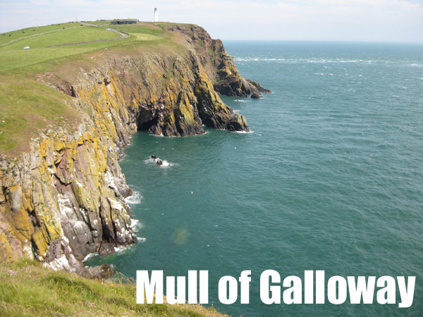
Introduction The Mull of Galloway is a wild and beautiful place to climb at the southernmost tip of Scotland. The crags out on the Mull itself, near the lighthouse, are very big and loose and with the added problem of being tidal. King of the routes here is definitely the full 4km sea level traverse... which took several days to pioneer.! However the area just south of West Tarbert, known as Carrickcorie, has more amenable climbing, with shorter routes on generally OK rock. Much of this area is non-tidal, but big waves would be a problem.
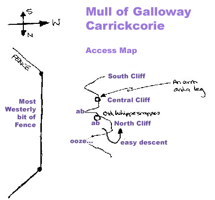
Access To get here follow the A77 or A75 towards Stranraer then the A716 down the east shore of the Rhinns to Drummore village. From here follow signs for the Mull of Galloway Visitor Attractions. West Tarbert beach and parking spots are at the obvious isthmus just before the road begins the final ascent to the lighthouse, and the Carrickcorie climbs are about 10 minutes walk from here. There is a wee sketch map of the final approach below, you need to get firstly to the bit of fence that is further west than any other bit of fence on the headland!
Guidebook For a definitive list of all the climbs here see the SMC published Lowland Outcrops guidebook.
Dangers These are greywacke sea cliffs with large areas of poor rock and areas where there is more vegetation or bird-shit than rock. Many of the routes require abseil approaches, so are very serious in nature and can be difficult to locate from above. This is a very open stretch of coast so climbing here will be hazardous in big seas or high winds and the area is very open to rapid weather changes. Dangers
Several areas are described briefly below, from north to south as they are approached from Tarbert.
Benwee
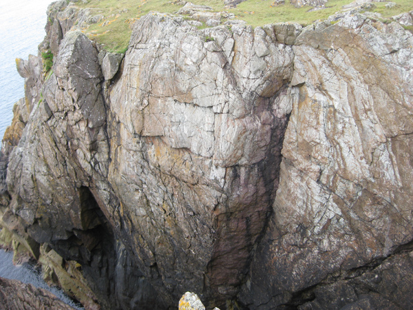
There are two climbing areas on either side of the narrow, grassy Benwee promontory. They are just 5 minutes from the road along the shore southwards form West Tarbert, where a wooden sheep fence joins the cliffs. The north side has some V.Diff's and Severe's that are hard to get to and hard to photo. The more accessible south side pictured below has some reputedly good E routes.
Carrickcorie North
Another area that is hard to photo, and in my experience the rock here was not too good. This area is about another 5 minutes walk south of Benwee, where a very small, oozing stream goes over the cliff just by a nice short grassy area - look for the moss rather than the water. The Carrickcorie North crag is just north of this stream, get to it by descending immediately right of the stream down a very nice Easy/Moderate ramp and slab - with much better quality rock than on the climbs themselves!
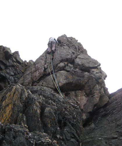
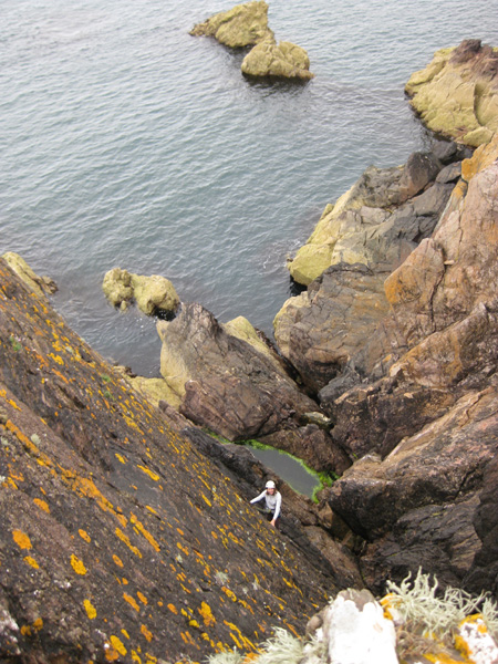
Pictured above are Linda Biggar on the arÍte of Slaritbartfast - nice line and nice climbing, but slightly dubious rock - and seconding the loose and unpleasant slab of Zaphod Beeblebrox (the leader cheated).
Carrickcorie Main
Access
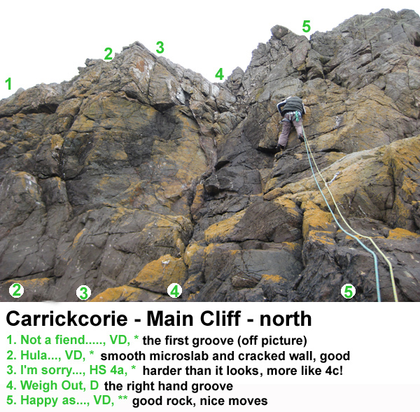
Get to the Carrickcorie Main crag by descending towards the sea about 30m south of the oozing stream mentioned above. This is an easy un-graded scramble. Then traverse easily southwards along the foot of the crags, which won't be possible in heavy seas. The north end of this Main Crag is just a few tens of metres from the descent route. Look for a very obvious and very polished rectangular grey slab, two metres high, which is the start of Hula.... This area has some pretty reasonable rock (for Greywacke) and is certainly the most relaxed place to climb at the Mull. The routes are quite short, but longer and harder than they first look. The names are a bit long., so they have mostly been abbreviated here out of sheer laziness. Try to guess the endings before looking them up in the SMC guidebook.!
Just around the corner to the south the crag steepens and gets bigger. There are a couple of good looking VS's and HVS's out on the nose here, but they can be a little wet. Then the biggest area of crag appears, the most obvious feature is the distinctive high wide crack of "An Arm and a Leg". Access can be as above for the north crag but with a very long scramble (difficult at high tide/big seas), or you can abseil down the line of Old Whippersnapppers off a big block, or you can abseil (possibly downclimb) the shallower gully a little further south, off a dodgy but safe rocking block! (this gully lies between Whippernsappers and the two excellent VS's). All three descents are marked on the sketch map above.
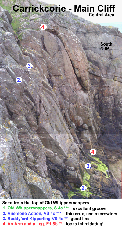
The two VS's, Anenome Action and Ruddy'ard Kiperling are both good, but maybe not quite as well protected as the guidebook implies!
South Cliff
Around the corner from "An Arm and a Leg" is the southern end of the Main Crag. There are a couple of good V. Diffs here on the southwest facing slab, on the steeper northwest facing wall several VS and HVS routes have been recorded.
Mull of Galloway
Some of the biggest cliffs in Galloway are located here just by the lighthouse and visitor centre. However the cliffs are heavily populated by seabirds and are much bigger, looser and scarier than those at Carrickcorrie... ..maybe best just to have a cafe latte in the visitor centre cafe and chill out.!
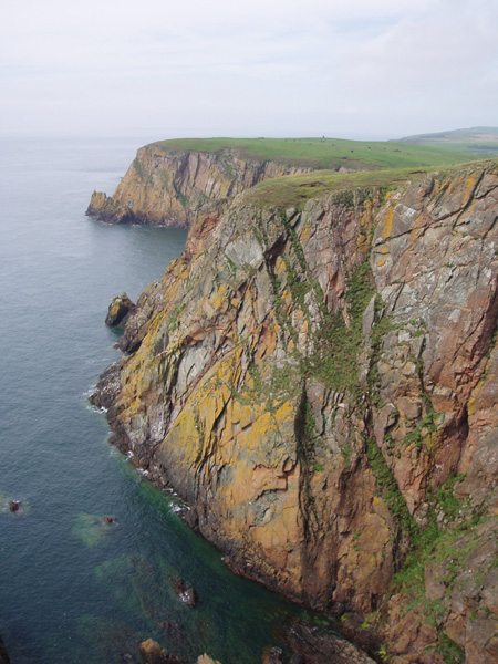
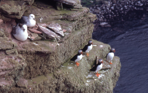
The cliffs of Gallie Crag, where Galloway's first seacliff route, Vomit, was recorded in 1971.... Meet the local residents, most probably responsible for the name (though actually pictured on holiday at the Old Man of Hoy in Orkney).
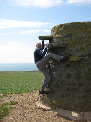
The only route I have done so far out near the Mull itself is the underside of the descent route on Kennedy's Cairn, at about Diff., but strenuous for the grade. Note the specialist leisure footwear.
For information on tourist services in this area see the Mull of Galloway website.

